Shuswap Lake is high but its rise has slowed somewhat thanks to slightly cooler weather over the long weekend.
Derek Sutherland, the Columbia Shuswap Regional District’s (CSRD) protective services team leader, said the rapid lake-level rise of between 11 and 18 centimetres per day has slowed. A nine centimetre rise was measured on May 21 and a 7.5 centimetre rise on May 22.
“We’re still encouraging people to prepare early for the flood and have an evacuation plan,” he said.
Sutherland said sandbags are being provided in every neighbourhood prone to flooding from the lake.
He added the lake traditionally peaks the second week of June, but everything started about two weeks early this spring.
“It started a lot earlier this year, but it’s not expected to finish any earlier.”
Despite the slowed elevation, the CSRD is telling residents along Shuswap and Mara lakes to prepare for lake levels similar to 2012, which current levels are less than a metre below.
“Flood waters move fast, so develop a household plan, put together your emergency kit and connect with your neighbours. If you face a threatening flood situation, park vehicles away from streams and waterways, move electrical appliances to upper floors and make sure to anchor fuel supplies. Listen to local officials if you are asked to evacuate,” a press release from the regional district reads.
CSRD officials recommend residents have a grab-and-go kit ready in case they have to leave their homes quickly. They also suggest keeping important papers in a watertight container and keeping a record of valuables in a safe place.
Residents are also being advised to watch out for warning signs such as an increase in the height and intensity of water flows, mudslides, debris in creeks or changes in the colour of water.
Evacuation planning, including arrangements for pets and livestock, is being recommended to those who live near the lake as is looking out for elderly or disabled neighbours.
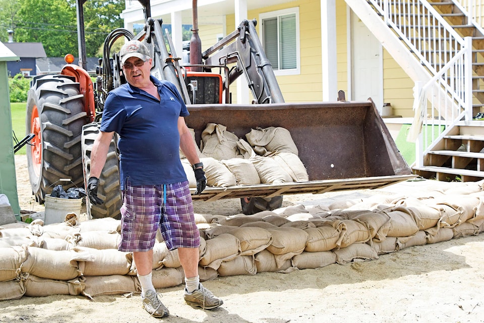
One lakefront resident who is preparing for, but not expecting, the worst is Russ Tompkins who lives near the wharf in Canoe.
“I hope I’m wasting my time here,” Tompkins said as he filled sandbags on May 18.
Tompkins’ home, where he lives with his spouse Sandra, has been in their family for 30 years but they bought it about four years ago. He explains that the people who owned it in 1972, one of the highest years on record for lake levels, raised the house to escape flooding.
“But this might be the year the house gets wet.”
Water levels are going down in the rivers which feed into Shuswap Lake. According to the B.C. River Forecast Centre, the Eagle River hit its peak level on May 17 and receded 35 centimetres before climbing again on May 23.
The Shuswap River has overflowed its banks in some areas, flooding low-lying properties. It remains close to the peak water level it reached on May 20 but has now receded slightly.
North of Sicamous, the Seymour River is also beginning to recede.
The Salmon River, which flooded properties in Silver Creek, has receded more than 60 centimetres since it hit its peak.
-With files from Martha Wickett