The Ribbons of Green Trails Society has launched a new interactive trail map of the Greater Vernon area on their website.
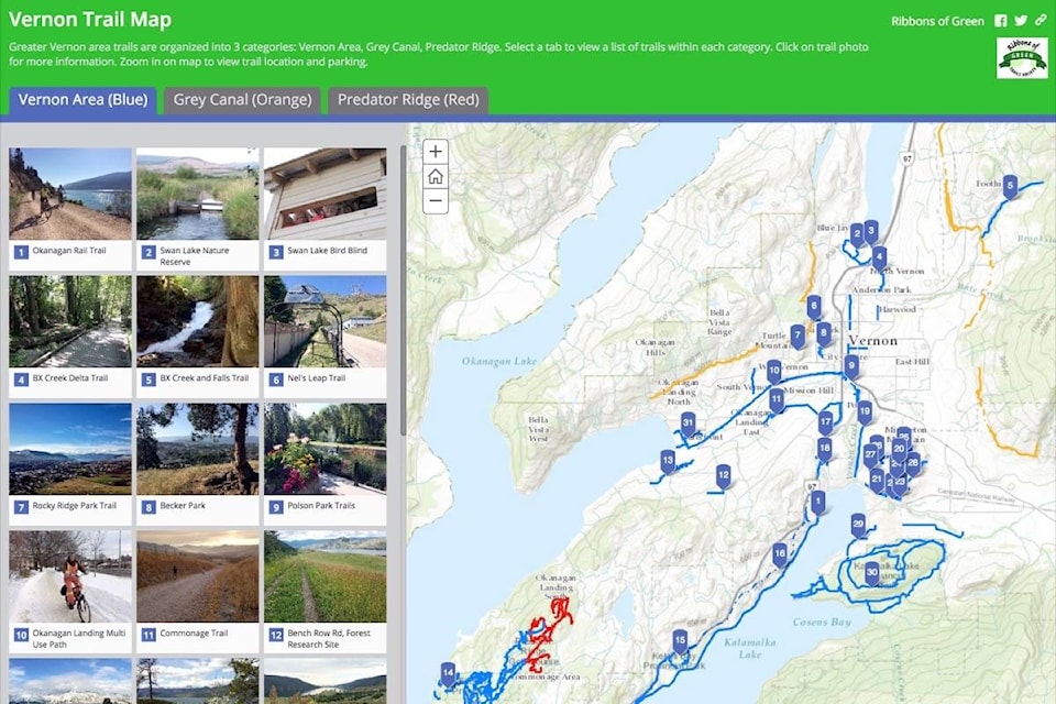
The map includes photos, trail information, and access directions. Trails are divided into three categories: Vernon Area, the Grey Canal trails, and Predator Ridge trails.
“You can easily see at a glance where the various trails are located around Greater Vernon”, states Ingrid Neumann, Ribbons of Green Director who was involved with creating the map. Click or tap on a coloured trail on the map to view the trail’s name. Click or tap on a trail photo to display further trail information such as features, access, parking, distance, difficulty, trail surface, and whether dogs are allowed. Zoom in on the map to view trail location and parking.
The Interactive Map can be viewed on smartphones, tablets, and computers.
To view the Interactive Map, visit www.arcg.is/iSnWn
The Ribbons of Green Trails Society has been actively pursuing the promotion and creation of walking, hiking and cycling trails within the Greater Vernon area for 26 years. One of the society’s main goals is to create an off-road trail system that connects Swan Lake, Okanagan Lake and Kalamalka Lake.
For more information about the Ribbons of Green Trails Society, visit their website at www.ribbonsofgreen.ca