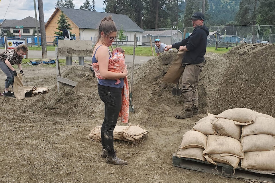
The Regional District of North Okanagan has set up three self-serve locations for residents to access sand and sandbags for flood prevention measures.
They include:
• City of Enderby Public Works Department, 2308 McGowan St.;
• Parking lot between Lumby Curling Rink and Pat Duke Arena, 2270 Shields Ave.;
• City of Vernon Public Works Yard, 1900-48 Ave. Access at the back gate on Pleasant Valley Road.
Flooding is a common, naturally occurring event in B.C., and although it can happen any time of year, the most severe floods typically occur in spring due to snowmelt and heavy rainfall. Property owners are responsible for flood protection on their private property and are encouraged to plan ahead.
“As freshet begins, we encourage residents to consider their flood risk and prepare accordingly. Don’t wait for the water to come – make your emergency plan today,” said Ashley Gregerson, RDNO communications officer.
“On average, it takes two people about one hour to fill and place 100 sandbags, which is enough for a wall one-foot high and 20-feet long. These are self-serve venues, so please remember to bring your own shovel and contact your neighbours, family, and friends if you need assistance filling and placing sandbags.”
The regional district advises any person working near creeks, streams and rivers to use extreme caution and safety measures. Fast-moving water may cause erosion and bank instability.
Residents can sign up for the emergency management e-newsletter at www.rdno.ca/subscribe. For more information on flood preparedness, please visit the RDNO’s website.
CITY OF VERNON PREPS FOR FRESHET
Spring freshet is underway throughout the North Okanagan, which means creek levels throughout Vernon may be fluctuating.
The city is conducting its regular, annual freshet preparations by actively monitoring creek levels and provincial snowpack reports for the local area and checking city infrastructure that could be impacted by increased water levels such as road, culverts, outfalls, bridges and storm retention structures.
“The water level and creek flow has started to increase along Upper and Lower B.X. Creeks and in Vernon Creek; however, at this time, all three creeks have additional capacity available,” said Sean Irwin, utilities manager. “Utility crews have removed sediment from the two sediment basins located on BX Creek and the City is closely monitoring the weather and snow melt conditions in higher elevations.”
“Every year we monitor snow pack melt along with seasonal spring rains, as together these factors can result in excessive volume entering the natural water systems,” said Sue Saunders, Emergency Program Coordinator. “If the forecast holds sudden and prolonged high temperatures or heavy precipitation, the risk of flooding can increase. Creek levels can rise rapidly, and those with properties near the creeks, or with historic risk of flooding are encouraged to consider their level of preparedness.”
Private property owners are reminded they are responsible for protecting their property from flood and flood-related risks, as indicated in the city’s Streamside Maintenance Policy. The city encourages all property owners adjacent to creeks and streams to consider whether they are prepared for rising water levels and what steps they may need to take to maintain and protect their property.
READ MORE: Popular Vernon dog parks close for upgrades
READ MORE: Vernon woman traps historic certification
roger@vernonmorningstar.com
Like us on Facebook and follow us on Twitter.