New mapping shows the Bunting Road wildfire is smaller than previously thought, according to a BC Wildfire Services (BCWS) report.
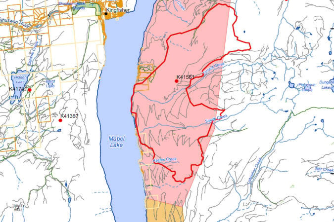
The provincial agency said clearing smoke has allowed aerial crews to collect more accurate data and is now mapping the fire burning out of control east of Mabel Lake at approximately 3,487 hectares.
Previously it was estimated near 5,000 hectares.
Seven firefighters and nine helicopters are assigned to the fire and crews have made progress on securing the west side of the fire near the lake. A guard has also been completed on the south end and work continues on the west side.
Mabel Lake Forest Service Road remains closed between kilometres 14 and 40 and those who ignore the closure and drive into the active fire area are reminded this not only creates a safety hazard for themselves but to first responders in the area.
“Please respect and obey this closure,” BCWS said.
Evacuation orders are still in effect for Regional District of North Okanagan residents between the 6,000-17,000 block of Mabel Lake FSR, including Cottonwoods and Cascade Beach Recreation Site.
Alerts remain, too, for properties between the 3,300 and 6,000 block of Mabel Lake FSR.
READ MORE: White Rock Lake wildfire forces more evacuation orders for Westside Road
READ MORE: Lifting smoke brings air support back into battle at blaze near Mabel Lake
@VernonNews
newsroom@vernonmorningstar.com
Like us on Facebook and follow us on Twitter.